Latest Version
Released:May 28, 2026
Description:
AniMACCS 1.4.0
SHA1 checksum value:
e289c01bae4bf5e3a34367b06935446510461af8
Notes
AniMACCS 1.4.0 corrects issues where both OpenStreetMap and Stamen maps were not rendering due to URL changes by the map providers. Upgraded to Java 21.
About AniMACCS
Over a map of the geographical area, AniMACCS uses the results of the ATD calculations to create an animated video of the simulated plume segment movement and animated videos of the time-dependent air and ground concentrations. These animated videos can help the user understand the event and communicate the results.
Example Animations
The first example shows plume segment movement for the sample file, “Model1.plum”, which is supplied with AniMACCS. This shows a hypothetical release from the Sequoyah Plant in Tennessee. Each plume segment corresponds to a 1-hour duration plume and travels in the direction of the wind at the time of its release from the nuclear site. The color of each plume segment is only used to distinguish one from another; it is not indicative of any of the properties of the plume.
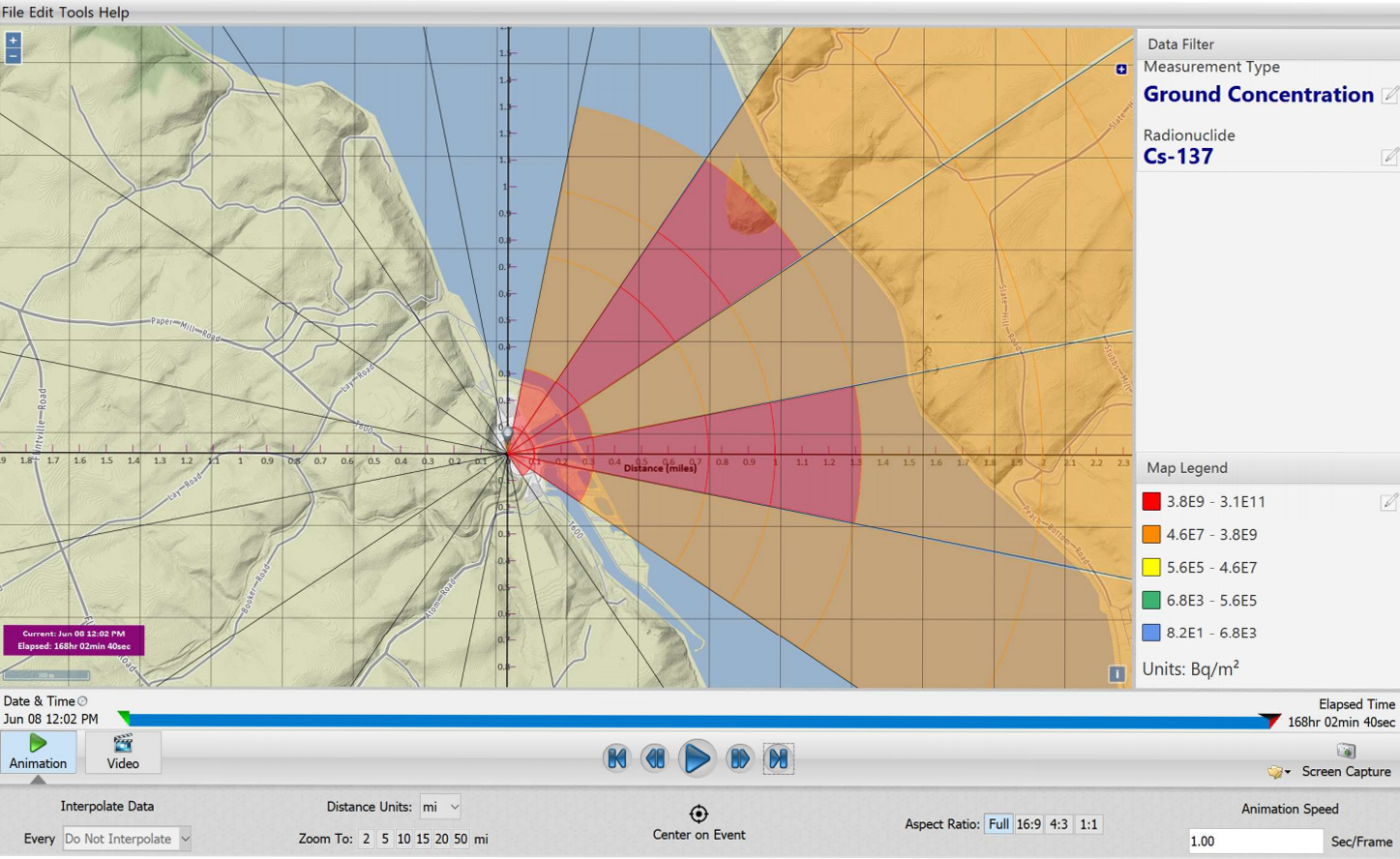
Plume Segment Animation, from SAND2020-8732The second example shows the ground concentration of Cs-137 for the sample file, "Model1.gac", which is also supplied with AniMACCS. Here the colors are used to indicate the ground concentration levels in units of nCi/m2. The user can change the measurement units (e.g., Bq/m2) and can customize the color scales as they prefer.
Ground Concentration Animation, from SAND2020-8732Release Notes
SAND2025-05197W