AniMACCS is a utility code in the MACCS software suite that allows for certain
MACCS output information to be visually displayed and animated onto a geospatial
map background. AniMACCS was developed by Sandia National Laboratories for the
U.S. Nuclear Regulatory Commission.
MACCS is designed to calculate health and economic consequences following a release of
radioactive material in the atmosphere. MACCS accomplishes this by modeling the
atmospheric dispersion, deposition, and consequences of the release, which depend
on several factors including the source term, weather, population, economic, and
land-use characteristics of the impacted geographical area. From these inputs,
MACCS determines the characteristics of the plume, as well as ground and air
concentrations as a function of time and radionuclide.
AniMACCS opens plume segment movement files (.plum) and ground and air concentration
files (.gac) created by MACCS 4.0 and animates them over a map of the geographical
area. Users may zoom in or out, drag the map to move the release location off-center,
play the animation video, modify animation start and end times, speed up or slow
down the animation video, modify units, modify display colors, perform custom
interpolations, choose layers that are displayed, take screen captures, and
export animations to video files.
Click here for the AniMACCS User Guide, SAND2022_0403
EXAMPLE ANIMATIONS
The first example shows plume segment movement for the sample file, “Model1.plum”,
which is supplied with AniMACCS. This shows a hypothetical release from the Sequoyah
Plant in Tennessee. Each plume segment corresponds to a 1-hour duration plume and
travels in the direction of the wind at the time of its release from the nuclear site.
The color of each plume segment is only used to distinguish one from another; it is
not indicative of any of the properties of the plume.
Plume Segment Animation, from SAND2020-8732
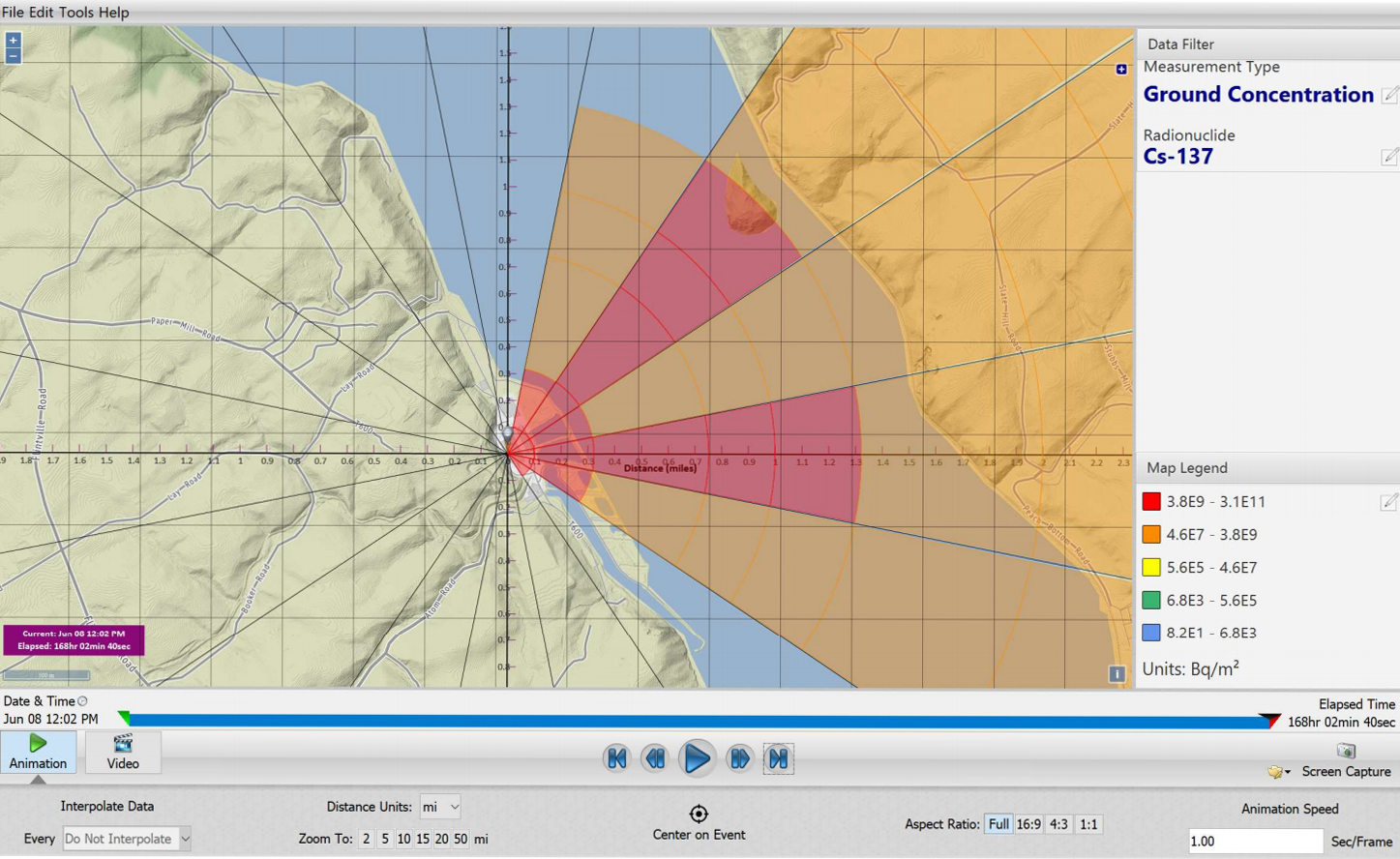
The second example shows the ground concentration of Cs-137 for the sample file,
"Model1.gac", which is also supplied with AniMACCS. Here the colors are used to
indicate the ground concentration levels in units of nCi/m2. The user can change
the measurement units (e.g., Bq/m2) and can customize the color scales as they prefer.
Ground Concentration Animation, from SAND2020-8732